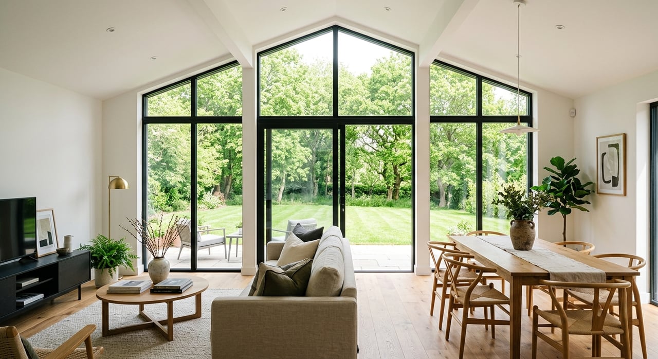
Are you seeing words like littoral rights, OHWM, or shore path in Lake Geneva listings and wondering what they really mean for your day-to-day life on the water? You are not alone. Buying on Geneva Lake is different from buying a typical suburban lot, and the details matter. This guide breaks down the key terms, the rule makers, and the practical questions to ask so you can move forward with clarity and confidence. Let’s dive in.
Quick lakefront glossary
Riparian or littoral rights: The rights that come with owning land along a navigable waterbody, including access, boating, and reasonable docking. Why it matters: These rights shape whether you can install or keep a pier and how you use the water next to your property.
Ordinary High-Water Mark (OHWM): The legal line that separates upland from lakebed or wetland. Why it matters: Setbacks and many permits are measured from the OHWM, not the water’s edge on a given day.
Easement: A recorded right for someone else to use part of a property. Appurtenant easements run with the land; easements in gross benefit a person or entity. Why it matters: Easements can allow neighbors or the public to pass along the shore or limit where you place fences or landscaping.
Shore path: On Geneva Lake, many parcels are subject to a historic shore path that allows pedestrian access along the lakefront. Why it matters: A shore path easement affects privacy, where structures can go, and how people may legally pass near the water’s edge.
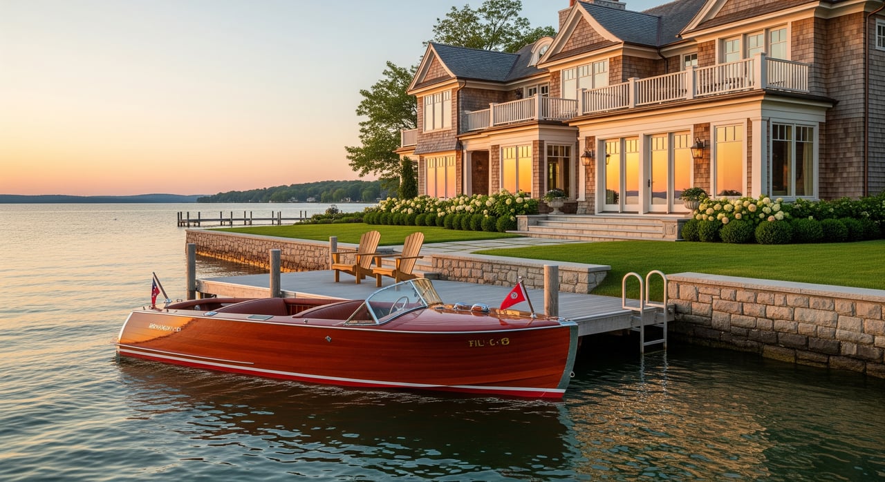
Pier or dock: A structure that extends from the shore into the water. Some are fixed on pilings; others float. Why it matters: Length, type, and placement are regulated, and replacing or enlarging a pier can require permits.
Pier setbacks and length limits: Local rules control how far a pier can extend, distance from property lines, and number of boat slips. Why it matters: The shoreline shape and local code may limit boat size, slip count, or layout.
No-wake zone: Areas where boats must travel slow enough to create no wake. Why it matters: No-wake rules affect water-skiing, tubing, and speeds near docks and beaches, and they are enforced by local marine patrols.
Accretion and reliction: Natural shoreline changes that add land or expose lakebed. Why it matters: Over many years, boundaries can shift and affect future development rights.
Public trust doctrine: The public has the right to use navigable waters for navigation and recreation. Why it matters: Owning lake frontage does not give exclusive control of the water surface.
Shoreland zoning: Rules that govern setbacks, lot sizes, and development near the water. Why it matters: Plans to expand a home, add a garage, or change the shoreline are subject to these regulations.
Riprap or seawall: Shoreline stabilization methods that often require permits. Why it matters: Costs and approvals can be significant, and work near or below the OHWM brings added oversight.
How rules work on Geneva Lake
Lake use and shoreline changes in Walworth County follow a layered system of oversight. The Wisconsin Department of Natural Resources sets statewide standards for navigable waters, shoreland protection, and many permits for work near or below the OHWM. Walworth County and the municipalities around the lake adopt and enforce local shoreland zoning and building codes. They also set specifics for piers, moorings, boat speeds, and harbor permits.
Local marine patrols and the sheriff’s department enforce boating laws and no-wake zones. Organizations like the Geneva Lake Conservancy may hold or help enforce shore path easements and support conservation work. The key takeaway for you is simple: expect to check with the municipality where the property sits and the county zoning office before assuming you can add a pier, extend one, or alter the shoreline.
Common permits include dock or pier approvals, shoreline alteration, and buoy or mooring placement. Variances are sometimes needed if you want to build closer to the water than setback rules allow. Because ordinances can change, verify the current requirements with the City of Lake Geneva or the specific village or township for your parcel.
Access types you’ll see in listings
Fee-simple frontage
You own direct shoreline and typically hold riparian rights. This scenario usually offers the strongest practical control over a pier and shoreline use, subject to permits and public rights on the water’s surface. A current survey and title review help confirm the extent of your rights and the exact location of the OHWM.
Deeded access easement
Your property is inland, but a recorded easement grants lake access across another parcel. These easements often define who can use the path or beach and for what purposes. Ask how many owners share the easement, where you can store equipment, and whether docks or moorings are allowed.
Association or condo common access
An HOA or condo owns the shoreline and manages docks, moorings, and rules. Members may get slips by assignment or waitlist. Review the governing documents for dock eligibility, guest policies, rental limits, and assessments.
Dry lot near public access
No private frontage, but you are close to public launches or beaches. This is lower cost than exclusive frontage, but you will rely on public ramps and schedules. You will not have private riparian rights or a personal dock.
Special parcels
Some properties have unusual title history, lakebed ownership questions, or a shore path crossing in a unique way. If the deed language is complex or unclear, plan for added title work and possibly legal advice.
What affects your pier plan
- Property lines and setbacks: Piers must respect side-lot lines, and the angle of the shoreline can limit layout. A survey that shows the OHWM and lot lines is essential.
- Length and slip count: Local codes can limit how far a pier extends and how many boats you can berth. Seasonal rules may also apply.
- Neighboring docks: Spacing between piers affects navigation and safety. Crowded shorelines are common on Geneva Lake, so thoughtful placement helps avoid disputes.
- No-wake and safety zones: Your shoreline may be near posted zones that affect how and when you use the water. Talk with local marine patrol about enforcement patterns.
The shore path and your privacy
Geneva Lake is known for a historic, continuous shore path created through easements and agreements over time. On some parcels, a recorded shore path easement allows pedestrians to pass along the water’s edge. This is part of the lake’s character and a key item to confirm during due diligence.
Ask whether a shore path easement crosses the property, where it is located relative to the house, and what structures or landscaping are allowed near it. The presence of a shore path does not mean the public can use your lawn or dock. It typically means a defined route exists where pedestrians may pass. Understanding the exact language will set the right expectations for privacy and use.
Your lakefront due diligence checklist
Documents and verification
- Request the deed and any recorded easements or covenants that affect the shoreline, including shore path or public access rights.
- Order a current boundary survey showing property lines, the OHWM, and any easements. Ask the surveyor to identify the OHWM where needed.
- Pull municipal permit history for existing docks, seawalls, boathouses, and shoreline work. Confirm that permits were properly issued and closed.
- Ask the title company to investigate lakebed ownership and any historic grants that may affect rights.
- If in an HOA or condo, review rules on docks, moorings, rentals, guest use, storage, and assessments.
On-site checks
- Walk the shoreline and note pier locations, neighboring docks, buoys, and posted no-wake markers.
- Confirm the type and condition of the existing pier and whether it is permitted or grandfathered. Ask if replacement must meet current code.
- Observe shoreline stabilization, such as riprap or a seawall. Ask about erosion, recent repairs, or planned projects nearby.
Smart questions to ask
- Do recorded easements cross this parcel, including any shore path? Where is the path located and how is it maintained?
- Who owns the adjacent lakebed and how is that confirmed in title?
- What are the local limits on pier length, slip count, moorings, and motor types, and where are those rules published?
- Are there posted no-wake or seasonal speed rules along this shoreline, and who enforces them?
- Have there been recent permits, variances, or enforcement actions tied to this property?
- Are any assessments pending for shoreline projects or association improvements?
- Is the property in a shoreland overlay, wetland setback, or floodplain that affects rebuilding or expansion?
Contingencies and pros to involve
- Add inspection coverage for shoreline structures and erosion.
- Require a title commitment that specifically searches for shore path or beach easements.
- Include a survey contingency to confirm property lines, the OHWM, and potential pier setbacks.
- Consult a local real estate attorney for complex easements or title questions.
- If planning shoreline work, bring in a shoreline contractor or engineer early to estimate permits and costs.
Local resources to contact
- City of Lake Geneva building and zoning offices for municipal code and harbor or boat permits.
- Walworth County Land Use and Resource Management for shoreland zoning maps and permits.
- Wisconsin Department of Natural Resources for docks, piers, navigable waters, and shoreland zoning guidance.
- Walworth County Sheriff’s Department Marine Unit for no-wake maps and enforcement questions.
- Geneva Lake Conservancy and local lake associations for shore path history and conservation efforts.
- Local title companies, surveyors, shoreline contractors, and real estate attorneys experienced with Geneva Lake properties.
When to bring in extra help
If the deed references easements, if the shore path crosses in an unusual way, or if you are planning a new pier or seawall, loop in the right professionals early. A current survey and a thorough title search will reduce surprises. For many buyers, a short consultation with a local attorney or shoreline engineer is a smart investment that keeps your project and timeline on track.
Ready to find the right Lake Geneva property and navigate the details with confidence? Connect with a local, hands-on advisor who understands shoreline rules, permit paths, and the lifestyle you want. Reach out to Dana Pierson-Emering to start a focused search or talk through your goals.
FAQs
What does the Ordinary High-Water Mark mean for building near Lake Geneva?
- The OHWM is the legal line used to measure setbacks and jurisdiction. Many building and shoreline permits are measured from the OHWM, not the waterline on the day you visit.
Can I add or extend a pier on a Lake Geneva property I buy?
- It depends on local ordinances, site constraints, and permits. Length, slip count, distance from lot lines, and navigation spacing all factor into approvals.
How does the Lake Geneva Shore Path affect my privacy and use?
- If a shore path easement crosses your parcel, pedestrians may have a defined right to pass along the shoreline. It does not grant use of your lawn or dock, but it can affect fencing, landscaping, and structures near the path.
Do I have exclusive control of the water in front of my home?
- No. Under the public trust doctrine, the public can use the surface of navigable waters for recreation and navigation, even adjacent to private shoreline.
What is the difference between fee-simple frontage and deeded lake access?
- Fee-simple frontage typically includes riparian rights and the strongest control over docking, subject to permits. Deeded access is a shared right to use a specific shoreline area and may limit docks or moorings.
Who enforces no-wake zones and boating rules on Geneva Lake?
- Local marine patrols and the Walworth County Sheriff’s Department handle enforcement. Expect to follow posted buoys, speed limits, and seasonal restrictions.